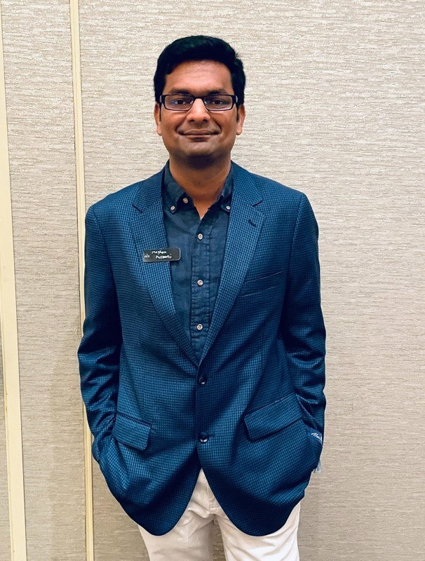
About Me
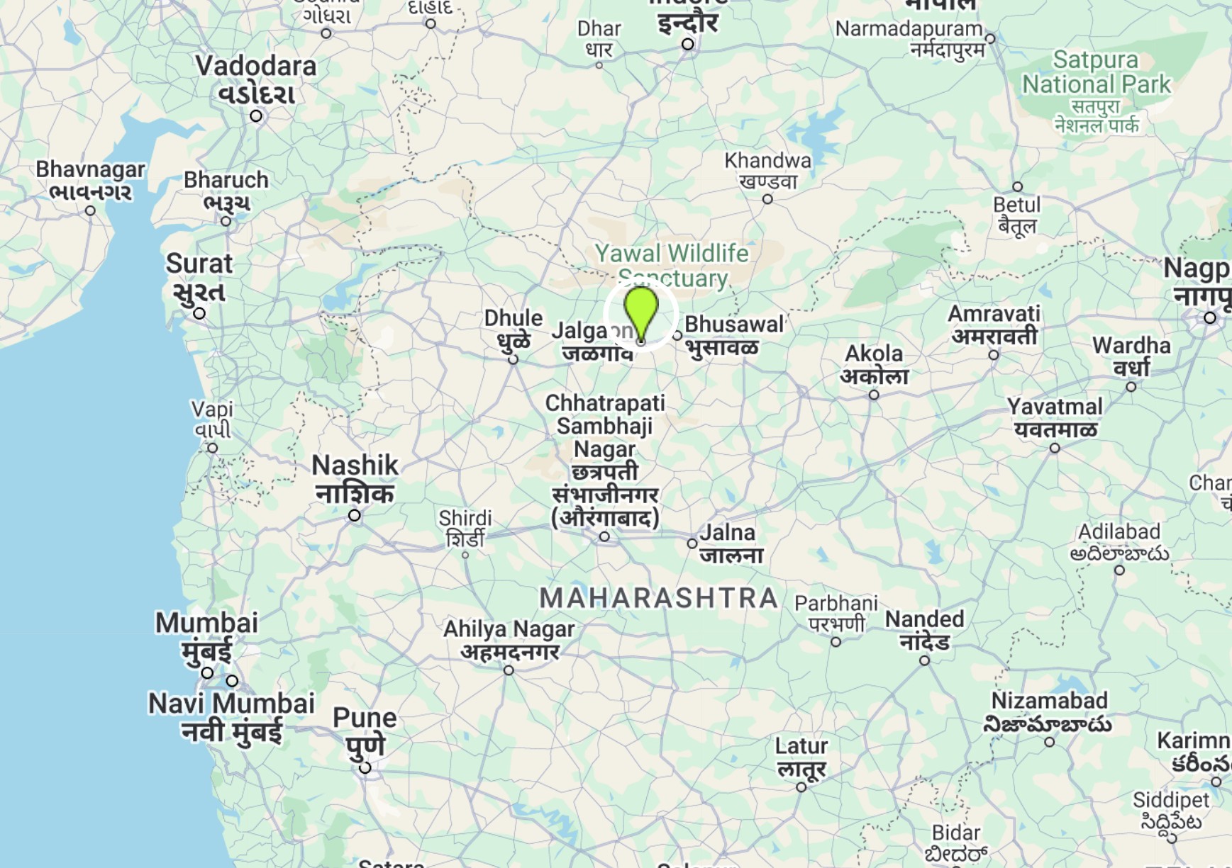
I was raised in Jalgaon, (21.0042° N (latitude) and 75.5639° E (longitude) for GIS geeks)
a quaint town nestled in the western region of Maharashtra, India.
My early education included completing high school and earning an Associate's degree in Jalgaon.
Subsequently, I relocated to Pune, Maharashtra—commonly referred to as the 'Oxford of the East'—to pursue
a Bachelor's degree in Information Technology. I had a natural affinity for memorizing the names of countries
and their capitals, nurturing a keen curiosity about geography.
I have very broad range technological experience ranging from Pro*c to HTML5. Python
is my favourite programming language though simply because of mandatory indentation.
I enjoy tackling programming challenges, particularly debugging and deconstructing code, followed by reassembling
and refining it. The process of identifying issues and implementing solutions keeps my problem-solving skills sharp
and fuels my passion for coding.
Please check out my work by clicking here.
Professional Experience

- Applied Information Sciences
Aug 2022 - Present
I am working as a React/GIS Developer with AIS. AIS has helped hundreds of global enterprises optimize their
technology investments to overcome IT challeges and drive cloud transformation challeges.
My work is primarily associated with end-to-end feature development for a React based Geospatial App built on top of ArcGIS API for JavaScript.
This involves creating, publishing, sharing and automating web maps built with ArcGIS for Desktop i.e., ArcGIS Pro (3.2)
I am working extensively with Imagery Layer, Map Image Layer service on ArcGIS Enterprise (11.2) utilizing Arcpy module to performance
various operations such as Overviews, Footprint identification, replacing BLOB service connection endpoints, etc.
- Mitchell Martin Inc (MMI)
Jun 2021 - Aug 2022
I worked as a GIS Applications Developer with MMI. Mitchell Martin is a leader in IT staffing,
with a presence across the U.S., India, and the Philippines. They focus on building relationships and understanding
the unique needs of each client and candidate.
My primary work was associated with writing cron jobs (with the help of arcpy module) to bring data into a GIS-enabled
DB for downstream consuming apps.
I also worked on onboarding Esri's GeoEvent Server to process and generate real-time triggers so that clients are
aware of social disruptions. More on Esri's
GeoEvent Server here.
- CentralSquare Technologies(CST)
May 2018 - May 2021
I worked as a Software Developer (GIS) with CST. CST is one of the leading software company
providing software support, maintenace, etc. for local governments within the US and Canada.
My work was primarily associated with feature development (primarity GIS-related). However, I also given added reponsibility
with maintenance. The product I worked with is built on top of ASP.NET MVC framework utilizing ArcGIS API for JavaScript
to consume various GIS services such as Map Image Layer, Imagery Layer, etc.
Before I was promoted as a Software Developer (GIS), I was working as a GIS Specialist responsible for GIS module
integration within CST Software. I developed custom python scripts utilizing Arcpy module built within Esri ArcGIS Enterprise
for importing GIS data into CST database schema.
- Town of Flower Mound
Oct 2017 - May 2018
I was a GIS Intern for the Town of Flower Mound in the Public Works department.
My primary work was to help Public Works department correct geographical location
for assets such as Fire Hydrants, Water meters, etc.
You can find more info related to this job by
clicking here.
- T-Mobile/Sprint
May 2017 - Aug 2017
I was involved with network simulation and throughput analysis project
which required accurate GIS data imported into network simulation
tool known to be as Atoll
You can find more info related to this job by
clicking here.
- MasterCard Technologies Pvt Ltd
Feb 2014 - July 2016
I worked at the MasterCard as a Software Engineer in the production support department
providing Level 2 Support. My work primarily involved heavy use of
PL/SQL, Pro*C, Unix Shell Scripting.
I was responsible for providing detailed technical analysis for reported incident, verify and reproduce
incident; advise on the resolution if necessary. I worked on suite of products such as
Prepaid/Forex/Gift Cards; Credit Cards; Debit Cards.
Education

-
Master of Science
Geospatial Information Science
2018 Batch
The University of Texas at Dallas
-
Bachelor of Engineering
Information Technology
2013 Batch
University of Pune, Maharashtra, India
-
Associate Degree
Computer Engineering
2010 Batch
Maharashtra State Board for Technical Education, Maharashtra, India
Projects
- Site Suitability analysis for Managed Aquifer Recharge
This project's main focous was groundwater recharge and identifying
merit of site. Groundwater recharge depends on several parameters such
as soil characterstics, precipitation levels, Geography and so on.
The state of Texas was selected as Study area and data was collected
from several different resources such as TNRIS.
Full project report is available here.
-
Intrusion Tolerant ARP Spoofing Detection and Prevention
This project's main focus was Network Security. Address Resolution Protocol (ARP)
has security vulnerability by which attackers can spoof MAC address of target machine and steal critical
personal information by employing Man-in-the-Middle (MiTM) attack.
Full project report is available here.
-
Potholes Identification using UAV 3-Band data
This project's main focus was potholes identification from UAV 3-band (RGB) data. This project
uses OpenCV library for image processing by employing Digital Number (DN) associated with remotely
captured UAV image and applying Nearest Neighbor (8 pixel) algorithm to determine pattern.
Certifications & Achievements

- Microsoft Certified: Azure Fundamentals
The AZ-900 certification, officially known as Microsoft Certified: Azure Fundamentals, is designed for individuals who want
to demonstrate foundational knowledge of cloud concepts and Microsoft Azure services.
It is ideal for beginners in cloud computing or those exploring Azure for the first time.
- Earth Imagery at Work
This certification is offered as Massive Open Online Courses (MOOC) by ESRI. This training provides basics for Digital Image processing
within ArcGIS environment.
- Mobile Field Data Collection
This certification is offerred by URISA Texas.
URISA is the premier organization for the use and integration of geospatial technology to improve the quality of life in urban and regional environments.
This course provides basics about GIS data collection, editing on-site
using apps such as Collector for ArcGIS.
- H.E.A.R.T. Award
Highlighting Excellence and Recognizing Teamwork (H.E.A.R.T.) was received when I was
working for MasterCard to completing reconcilliation differences within company's Prepaid
card app.
- Keith Lankford Taylor Scholarship
This scholarship was received in Spring 2017 for strong technical background comtinuous
excellent academic performance.